History
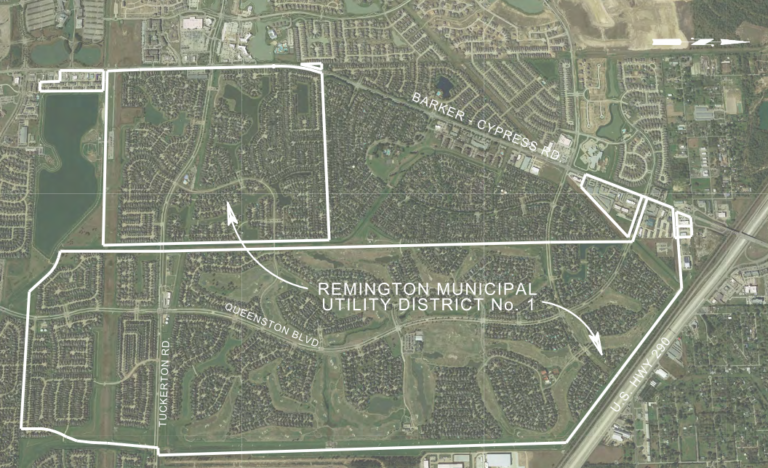
The District is a political subdivision of the State of Texas, created by Order of the Texas Water Commission, predecessor of the Texas Commission on Environmental Quality (the “TCEQ” or the “Commission”), on October 8, 1986. The District contains approximately 1,842.716 acres of land. The District is located entirely within Harris County, Texas, and entirely within the extraterritorial jurisdiction of the City of Houston, Texas. The District is located within the Cypress-Fairbanks Independent School District. The District is located approximately twenty-two miles northwest of the central business district of the City. The entrance of the District at the intersection of Queenston Boulevard and Barker-Cypress Road is located one-quarter mile south of the intersection of U.S. Highway 290 and Barker-Cypress Road. The District is generally bounded to the north by U.S. Highway 290 and on the west by Barker-Cypress Road. Queenston Boulevard traverses the District north to south. Cypress-North Houston Boulevard traverses the northern portion of the District east to west.
District Map